Engineering & Materials Science , Environmental Engineering
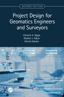
Project Design for Geomatics Engineers and Surveyors, Second Edition
Project Design for Geomatics Engineers and Surveyors, Second Edition, continues to focus on the key components and aspects of project design for geomatics and land surveying projects with the goal of helping readers navigate the priority issues when planning new projects. The second edition includes new materials on surveying and UAV, and it is thoroughly updated to keep current with the recent technology and terminology. The two new chapters capture new developments in the rapidly emerging use of remote sensing and GIS in aerial surveys, mapping, and imaging for small-to-medium scale projects, as well as modern practices and experiences in engineering surveying. 1. Provides a simple guide for geomatics engineering projects using recent and advanced technologies. 2. Includes new content on spatial data collection using GIS, drones, and 3D digital modeling. 3. Covers professional standards, professional and ethical responsibilities, and policy, social, and environmental issues related. 4. Discusses project planning including scheduling and budgeting. 5. Features practical examples with solutions and explains new methods for planning, implementing, and monitoring engineering and mining surveying projects. Undergraduate and graduate students, professors, practicing professionals and surveyors will find this new edition useful, as well as geospatial/geomatics engineers, civil engineers, mining engineers, GIS professionals, planners, land developers, and project managers.
- Ogaja, Clement
- CRC Press Inc
- 2023
- 281
- 9781032266794
Subcategories


